Chapter 1 Background
In response to Superstorm Sandy and associated Congressional directives (PL 113-2), the North Atlantic Coast Comprehensive Study (NACCS) identified nine focus areas with populations vulnerable to coastal flooding risk. Three of these areas are in the New York Bight ecosystem, where the U.S. Army Corps of Engineers (USACE) is conducting large-scale coastal storm risk management (CSRM) feasibility studies. The New Jersey Back Bays (NJBB) study is investigating 900 mi2 of land and water areas along with 3,400 mi of shoreline spanning a significant portion of New Jersey’s Atlantic coastline. The New York-New Jersey Harbor & Tributaries Study (HATS) is examining 2,100 mi2 and comprises parts of 25 counties in the two states. The Nassau County Back Bays (NCBB) study is investigating flood risk in 400 mi2 of land and water areas on Long Island’s southern shore. Objectives of these studies include issues such as: (a) reduction of coastal storm damage risks to communities, public infrastructure, important societal resources, and the environment, (b) improvement of a community’s ability to recover from storm surge damages, (c) enhancement of human health and safety by improving performance of critical infrastructure and natural features during and after storm surge events, and (d) enhancement of coastal resilience with nature-based features.
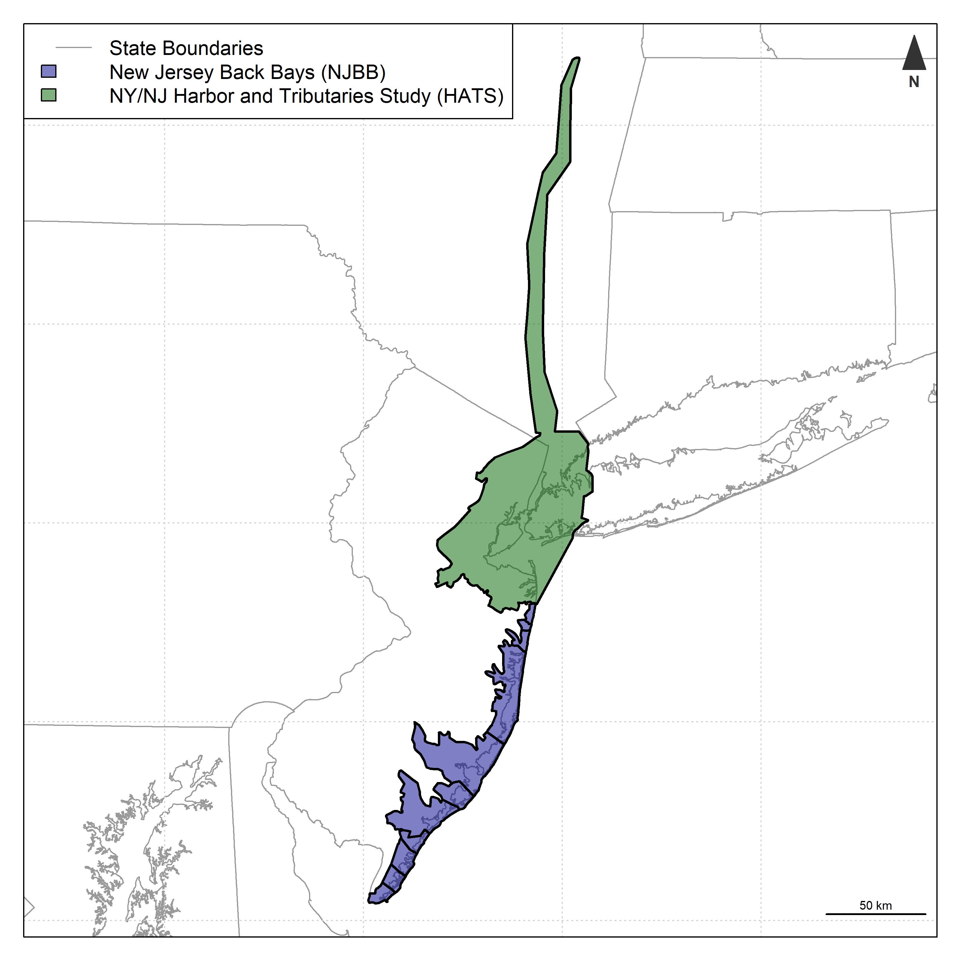
Figure 1.1: USACE regional coastal storm risk management studies. NJBB and HATS are the primary focus of model development.
In these study areas, the USACE is considering a diversity of measures for mitigating flood risks, including structural actions (e.g., levees, floodwalls, storm surge barriers), non-structural measures (e.g., buy-outs, elevation of structures, flood-proofing), and natural and nature-based features (NNBF, e.g., wetland creation, reefs for breakwaters). Environmental outcomes and acceptability are important constraints on plan selection, and recommended plans must be in compliance with environmental laws and regulations. Given the large spatial scope, these USACE studies are applying a “tiered” approach in compliance with the National Environmental Policy Act (NEPA). Tiered assessment intends to provide appropriate data at key planning milestones for complex studies with diverse environmental effects. In the context of these studies, a “Tier 1” Environmental Impact Statement (EIS) will be generated at the conclusion of the USACE Planning Process (i.e., in the Feasibility Report and Chief’s Report). The “Tier 1” EIS is being developed with sequentially more accurate and precise information as the planning process proceeds through key milestones such as the Alternatives Milestone Meeting (AMM), Tentatively Selected Plan Milestone (TSP), and Agency Decision Milestone (ADM). A “Tier 2” EIS will be developed in Pre-Construction Engineering and Design (PED).
1.1 Problem Statement
The conceptual and numerical models presented here seek to articulate and quantify mechanisms of environmental impact of proposed coastal storm risk management alternatives. The following goals guided model development:
Models should provide a general description of the relative environmental effects of large-scale alternatives, which can inform the feasibility process and NEPA assessments.
Models must be able to forecast environmental effects over the project planning horizon (50-100 years) based on physical changes to ecosystems resulting from both background processes (e.g., sea level rise) and project alternatives (e.g., change in tidal regime from storm surge barriers).
Models should assess environmental effects by ecosystem type (e.g., marine deepwater vs. estuarine intertidal) to inform mitigation actions.
Models should capture direct effects of actions at infrastructure locations (e.g., the footprint of a surge barrier) as well as indirect effects induced off-site from infrastructure (e.g., change in bay hydrodynamics associated with a storm surge barrier).
Models should be adaptable to new information and data as project planning proceeds.
Models should provide a consistent approach for environmental assessment, which can assist with communication of the cumulative effects of recommended alternatives across the region.
1.2 Report Overview
This report presents development and application of the New York Bight Ecological Model (NYBEM, “nigh-bem”), which will ultimately consist of two separate but interlinked models. First, an index-based modeling framework (i.e., a habitat-suitability-style, quantity-quality approach) is developed here to assess patch-scale effects for six ecosystem types (e.g., estuarine intertidal zones). Second, a network-based model will be developed in the future to assess system-wide connectivity for migratory, aquatic organisms (e.g., anadramous fish). This report documents the technical details, use, and relevant information for USACE model certification (EC 1105-2-412, PB 2013-02) for the patch-scale, habitat-suitability model. The following sections summarize the major elements of model development:
Model Development Process: Summarizes the general scope of the model and approach for development.
Conceptualization: Describes the overarching view of the structure and function of ecosystems in the New York Bight.
Quantification: Reviews the technical details and numerical code of the six ecosystem-specific, patch-scale models.
Evaluation: Assesses the model relative to underlying numerical accuracy, scientific theory, and usability.
Application and Communication: Describes an application of the NYBEM to assess the existing condition in the New Jersey Back Bays.